|
Since 1989 Tuhi Tuhi Communications has been researching and creating new resources. When we published TAKOA in 1993 we started developing and adding new resources each year.
|
We also developed partnerships with other organisations like Library and Information Association of New Zealand Aotearoa Te Rōpū Whakahau and The New Zealand Geographic Board Ngā Pou Taunaha o Aotearoa, who shared with us their resources to be included in TAKOA.
|
education resources
|
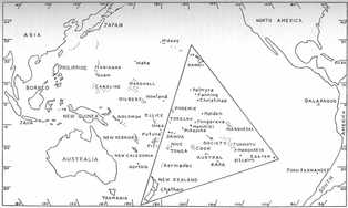
Map depicting the region of the Pacific Ocean anchored by Hawai'i, Rapanui Easter Island, and Aotearoa New Zealand.
|
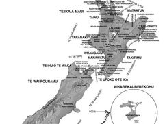
Updated version coming up. Iwi map created by Tuhi Tuhi Communications and first published in TAKOA
|
Updated version coming up. A resource for students and researchers listing Rohe-Iwi-Hapū-Marae
|
|
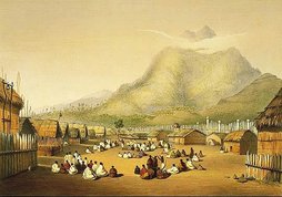
Pā sites map of the 18th and 19th centuries. The Pā painted (Angas 1846) is Kaitotehe, the pā of Pōtatau Te Wherowhero, with Mount Taupiri in the background , many Waikato ancestors and chiefs are buried on Taupiri, including all the Māori kings, and the late queen,
Dame Te Ātairangikahu. |
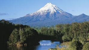
Tūpuna Maunga (ancestral mountains) hold a paramount place in our historical, spiritual, ancestral and cultural identity.
|

